CSX's Seneca River Montezuma Marsh trestles
The Seneca River Montezuma Bridge, commonly called the Montezuma Trestle, spans the Seneca River and part of the Montezuma Marsh on Hog Island, between Savannah, New York, and Montezuma, New York. The bridge is part of CSX's Rochester Subdivision. This line is a former Conrail, Penn Central Railroad, and New York Central Railroad line. The Seneca River at this location is the dividing line between Cayuga County (to the east) and Wayne Country (to the west).
Seneca River and NMWMA at Montezuma Trestle
 |
| Looking north, at Hog Island (right of the river) as CSXT 3453, CSXT 5461, CSXT 5314, CSXT 7793 lead Q367-15 west. |
The Seneca River flows from Seneca Lake, one of the Finger Lakes, east and northeast to the Junction of the Three Rivers, north of Syracuse, New York. The Seneca River flows from the south to the north here, but it is not the main river channel at this location anymore. The Erie Barge Canal is the primary channel now. The canal borders Hog Island from the southern tip of the island, where it diverges from the Seneca River, and flows to the northeast. The two water ways merge again at Haiti Island.
 |
| With the water level low, the Seneca River is flowing through a small five-foot-wide channel under the bridges. |
The surrounding area is part of the Northern Montezuma Wildlife Management Area (NMWMA). The NMWMA is a swamp and marshland that stretches to the south and north of the bridge. Hog Island and the former Howland's Island Wildlife Management Area, to the northeast of Hog Island, are part of the NMWMA. They are part of the larger, 50,000-acre Montezuma Wetlands Complex.
The Montezuma Trestle/Bridge
 |
| Looking east, as AMTK 701 leads P281-15 west on Track 1 across the Montezuma Trestle. |
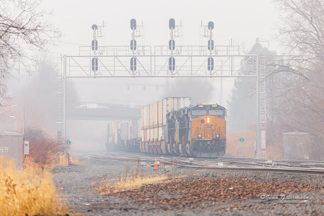
There are two bridges side-by-side here, though only one is operational. The older bridge carried two tracks, originally. Some of its piers have the date 1911 on them. The newer and currently used Montezuma Trestle, is the southern bridge, and it has two mainline tracks that are part of CSX's Rochester Subdivision. Some of its piers have the year 1984 on them, others have the year 1985 on them.
 |
| Looking east between the two bridges over the Montezuma swamp and marsh on Hog Island. |
The Montezuma Trestle sits just to the east of Control Point (CP) 320 (milepost (MP) 320.5) of the Rochester Subdivision. Per CSX's 2004 Albany Division Timetable, the bridge sits between MP QC 319.7 and QC 320.1. Most of the two bridges are in the Town of Montezuma, New York. The far western edges of the bridges are in the Town of Savannah, New York.
 |
| CSXT 42 leads Q634-14 east on Track 2 over the Seneca River and Hog Island. |
When measuring the bridges on Google Maps, their length is just under 1,800 feet. The bridges are deck plate girder bridges. The newer, and used bridge, sits on ninety-seven concrete piers. It appears that the old bridge also has the same number of piers.
 |
| Q634-14, a daily empty trash and manifest train, rolls east over part of the Montezuma marsh on Hog Island. |
Compared to a thru truss bridge, a deck plate girder bridge doesn't impose any height restrictions on the traffic crossing it. Clearance under the bridge is less, but since the Seneca River here isn't navigable, this isn't an issue. A half mile to the east of these bridges are two thru truss style bridges. One of them carries the Rochester Subdivision over the Erie Barge Canal. The other, like the older bridge here is unused.
 |
| Looking east, from the north side, down the unused Montezuma bridge. To the right empty debris cars on Q634-14 roll east on the current Montezuma Trestle/Bridge. |
Photographs taken on May 15, 2022, at Savannah, New York.


Nice use of the drone Tom
ReplyDeleteThanks a lot, Jim. I've had this plan on my photography list for a while.
DeleteVery interesting post! I agree with Jim with the drone shots. As I mentioned I am seriously thinking of getting one. With the wind here, probably won't get to use it often though.
ReplyDeleteThanks, Shelly.
DeleteLook for the max wind resistance rating of the drone. The DJI Mini 2 that I have is rate a 5. That equates to flying in winds up to 19-24MPH. A user on the DJI forums reported a test flight using the DJI Mini 2 in wind gusts up to 44MPH. The stronger the winds, the more the batter will be drain faster. Central New York has some really strong winds. It is referred to as "wind alley" by some.