Posts

Showing posts with the label Seneca River

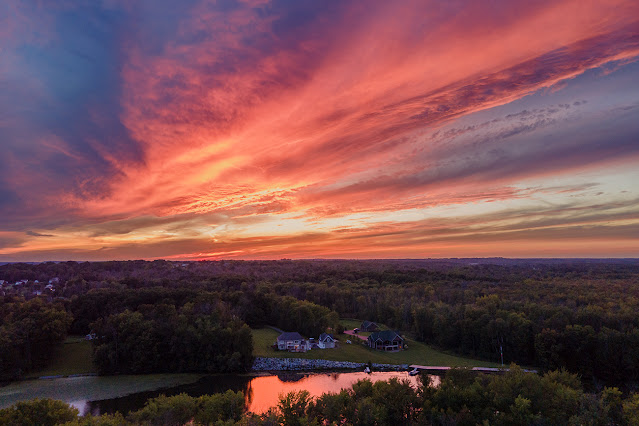
Late-summer sunset over the Seneca River
Image
A late-summer sunset reflects off the Seneca River at Liverpool, NY. This photograph is looking west across the Seneca River at Liverpool, New York . I captured this sunset last month a little over a week before the official end of summer. The sunset struck me as a sign that summer was almost over, and sure enough the temperature changed on a dime here in Central New York. One day I had the air conditioner running, and the next I had the heat on in case the house got too cold at night. 
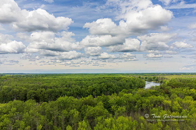
Clouds above the forest and the Seneca River in the spring

Image
  The last time I captured a view looking over the forest in my neighborhood, the trees were bare, the ground covered in snow, and more snow was falling. This week with spring in full bloom and the sky filled with some great-looking clouds, I sent the drone up again to capture the view. Looking northward toward the Seneca River at an above-ground-level altitude of 225 feet. Ash Trees and the Emerald Bore   A lot of the trees in this forest are ash trees. Many of them are infected by the Emerald Ash Bore (EAB) and are either dead or dying. According to the United States Department of Agriculture (USDA), the EAB, a type of beetle, is an invasive insect that most likely arrived in wood packing materials from Asia approximately thirty years ago. The EAB, as its name implies, bores holes throughout the tree, resulting in the tree's death. When the ash trees become infected by the EAB, an increased presence of woodpeckers occurs. The beetles are a food source for woodpeckers. The ...

CSX's Seneca River Montezuma Marsh trestles

Image
The Seneca River Montezuma Bridge, commonly called the Montezuma Trestle, spans the Seneca River and part of the Montezuma Marsh on Hog Island, between Savannah, New York, and Montezuma, New York. The bridge is part of CSX's Rochester Subdivision. This line is a former Conrail, Penn Central Railroad, and New York Central Railroad line. The Seneca River at this location is the dividing line between Cayuga County (to the east) and Wayne Country (to the west).  Seneca River and NMWMA at Montezuma Trestle Looking north, at Hog Island (right of the river) as CSXT 3453, CSXT 5461, CSXT 5314, CSXT 7793 lead Q367-15 west. The Seneca River flows from Seneca Lake, one of the Finger Lakes, east and northeast to the Junction of the Three Rivers, north of Syracuse, New York. The Seneca River flows from the south to the north here, but it is not the main river channel at this location anymore. The Erie Barge Canal is the primary channel now. The canal borders Hog Island from the southern t...

CP320 of the Rochester Subdivision - Northern Montezuma Wildlife Management Area

Image
 This past Saturday, I went to Savannah, New York, to check out control point (CP) 320 on CSX's Rochester Subdivision. The location is intriguing because the control point is on the southern edge of the Northern Montezuma Wildlife Management Area (NMWA) along the Seneca River and Crusoe Creek. Because of the spring thaw and lots of rain, the Seneca River and Crusoe Creek are flooding. I hoped the landscape would make an interesting backdrop. CP320 of the Rochester Subdivision Control Point (CP) 320 sits southeast of the confluence of the Seneca River and Crusoe Creek. It is to the west of the Seneca River and south of Crusoe Creek, along Railroad Road in the Town of Savannah, New York. CP320 is at milepost (MP) QC 320.5 of CSX's Rochester Subdivision (RS). Going east from CP320, the Rochester Subdivision first crosses over the original Seneca River channel on the  double-track Montezuma Trestle , a deck plate girder bridge. To the east of the trestle the line crosses over the ...

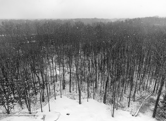
Snowfall over a forest by drone, near Syracuse, NY.

Image
We've had snow almost continuously on the ground here in the Syracuse area since just after New Year's. The snow has melted off a bit at times, but new snow always seems to fall. The day before I took this photograph a significant amount of the snow on the ground had melted off so that one could actually see the grass in places. However, that was short lived, and more snow fell overnight and the next morning.  Looking north over the forest behind my house. With a break in the snowfall and some sunshine breaking through the clouds, I set up my drone to practice using it some more and capture the forest behind my house again. As I was sending the drone up, the sky clouded up again and snow started falling. I quickly snapped a few shots and brought the drone back down to the ground. The river seen through the trees on the left side is the Seneca River. Photograph taken on February 18, 2022, near Syracuse, New York.

All images/photographs are copyrighted © by Tom Gatermann. All rights reserved. Contact me. Subscribe.