Posts

Showing posts with the label landscape photography

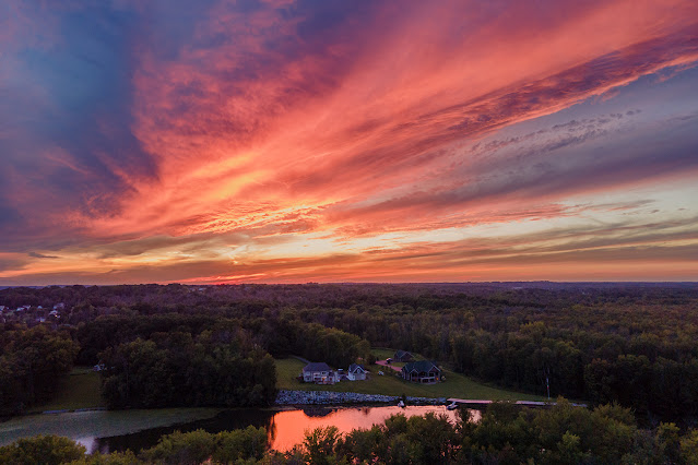
Late-summer sunset over the Seneca River
Image
A late-summer sunset reflects off the Seneca River at Liverpool, NY. This photograph is looking west across the Seneca River at Liverpool, New York . I captured this sunset last month a little over a week before the official end of summer. The sunset struck me as a sign that summer was almost over, and sure enough the temperature changed on a dime here in Central New York. One day I had the air conditioner running, and the next I had the heat on in case the house got too cold at night. 
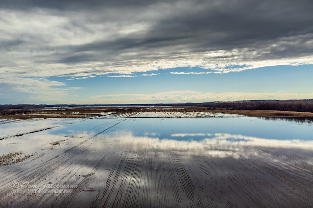
Cloud reflections in a flooded field at Savannah, NY.

Image
A flooded field along the Seneca River reflects the sky above at Savannah, NY. Back in March 2022, I was at Savannah, New York, photographing trains on CSX's Rochester Subdivision . This field, which sits along the western side of the Seneca River , was flooded by the river. The clouds were moving in from the west as another round of storms were coming. Photograph taken on March 19, 2022, at Savannah, New York.

Clouds above the forest and the Seneca River in the spring

Image
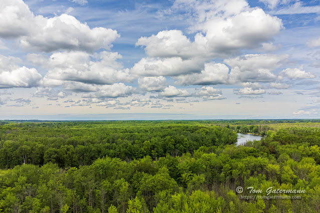
  The last time I captured a view looking over the forest in my neighborhood, the trees were bare, the ground covered in snow, and more snow was falling. This week with spring in full bloom and the sky filled with some great-looking clouds, I sent the drone up again to capture the view. Looking northward toward the Seneca River at an above-ground-level altitude of 225 feet. Ash Trees and the Emerald Bore   A lot of the trees in this forest are ash trees. Many of them are infected by the Emerald Ash Bore (EAB) and are either dead or dying. According to the United States Department of Agriculture (USDA), the EAB, a type of beetle, is an invasive insect that most likely arrived in wood packing materials from Asia approximately thirty years ago. The EAB, as its name implies, bores holes throughout the tree, resulting in the tree's death. When the ash trees become infected by the EAB, an increased presence of woodpeckers occurs. The beetles are a food source for woodpeckers. The ...

Views from Wilkerson Pass in the Rocky Mountains

Image
 Wilkerson Pass is situated among the Rocky Mountains, about fifty miles west of Colorado Springs, Colorado, and about eleven miles northwest of Lake George, Colorado. The summit of Wilkerson Pass looks out over the South Park Basin from the Front Range Mountains.   Wilkerson Pass' summit sits at 9,507 feet/2,898 meters above sea level. The Wilkerson Pass Visitor Center sits at the summit of the pass, on the south side of US 24. To the west you can see the Mosquito Mountain Range and to the southwest you can see the Collegiate Mountain Range. The Collegiate Mountain Range is part of the Sawatch Mountain Range. The South Fork South Platte River and the Middle Fork South Platte River flow through the basin. The confluence of the two rivers, south of Hartsel, Colorado, forms the South Platte River.  Mt. Yale is center-left, and Mt. Columbia is to the right, in this view from the summit of Wilkerson Pass. If you look toward the southwest from the visitor center over...

Snowfall over a forest by drone, near Syracuse, NY.

Image
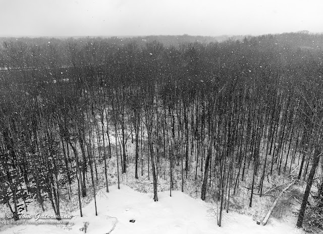
We've had snow almost continuously on the ground here in the Syracuse area since just after New Year's. The snow has melted off a bit at times, but new snow always seems to fall. The day before I took this photograph a significant amount of the snow on the ground had melted off so that one could actually see the grass in places. However, that was short lived, and more snow fell overnight and the next morning.  Looking north over the forest behind my house. With a break in the snowfall and some sunshine breaking through the clouds, I set up my drone to practice using it some more and capture the forest behind my house again. As I was sending the drone up, the sky clouded up again and snow started falling. I quickly snapped a few shots and brought the drone back down to the ground. The river seen through the trees on the left side is the Seneca River. Photograph taken on February 18, 2022, near Syracuse, New York.

A tree line view - Rocky Mountain National Park

Image
Rocky Mountain National Park While driving along Trail Ridge Road in Rocky Mountain National Park , this line of trees caught my against the mountains behind them. I like how the cloud passing overhead and casting its shadow on the mountain between the trees and the far mountain allows the trees to stand out a bit more from the background.  This photograph was taken approximately six to seven miles (9.65 to 11.2 km) north of the Kawuneeche Visitor Center along Trail Ridge Road (US 34). The Kawuneeche Visitor Center is north of Grand Lake, Colorado. Photo taken: September 4, 2013, at Rocky Mountain National Park.

Rocky Mountain National Park - Fairview Curve Viewpoint - I

Image
A view looking out from Fairview Curve Viewpoint , along Trail Ridge Road , in Rocky Mountain National Park. Unfortunately, while I know the image was taken looking out from Fairview Curve Viewpoint, I am not sure which mountain this image is showing. I believe this photograph's view is looking toward Red Mountain. Photo taken: September 4, 2013, Grand Lake, Colorado.

A dash of light, seen from Mount Evans in the Rocky Mountains

Image
A view from Mount Evans While driving down from Mount Evans, in the Rocky Mountains , I spotted this streak of light poking through the clouds. The view is looking west, from Squaw Pass Road (Rt. 103), toward a ridge line between Alpine Peak and Sugarloaf Peak. There had been a bit of rain on and off as I drove down from the summit of Mount Evans, but by the time I reached this point the clouds were starting to break up and the rain was moving away. Photo taken: September 2, 2013, west of Evergreen, CO., and southwest of Idaho Springs, Colorado.

Rock Island in Lake Mead

Image
This view is looking out at Rock Island in Lake Mead. You can see, from the lighter colored rocks, how the water level of the lake was significantly lower than in years past. August 18, 2010. Lake Mead National Recreation Area, Nevada.

Looking Toward Long Point On Cape Cod

Image
Long Point Lighthouse and Wood End Lighthouse In this view, both Long Point Lighthouse and Wood End Lighthouse can be seen. Long Point Light is closest, while Wood End Light is far off in the distance (to the right of the photograph). This image was taken from the Bay Lady II sailing boat as it sailed around Cape Cod during a sunset cruise. September 8, 2017. Provincetown, Massachusetts. Photo © Tom Gatermann. All rights reserved.

Visitors center and power line towers at Hoover Dam

Image
Visitors Center at Hoover Dam Looking toward the visitors' center and some of the power line towers at Hoover Dam . In the upper left corner of the image you can see the Mike O'Callaghan - Pat Tillman Memorial Bridge. At the time that I took this image, the bridge was under construction. Before the bridge was completed in 2010, vehicular traffic on US 93 had to cross over the top of the dam, which required a security check fro every car traveling over it. Photo taken: August 18, 2010. Hoover Dam, Lake Mead National Recreational Area, Nevada. Photo © Tom Gatermann

The Historic Railroad Hiking Trail at Lake Mead

Image
This is view is of one of the many hills that dot the landscape around Lake Mead . In the foreground is Historic Railroad Hiking Trail. Photo taken: August 18, 2010. Lake Mead National Recreation Area, Nevada.

A view of Lake Granby and Rocky Mountain National Park

Image
Lake Granby While driving up US 34 from Granby, Colorado, to Rocky Mountain National Park , I stopped off at Lake Granby. This view is looking eastward out over Lake Granby, toward Rocky Mountain National Park. This location is, approximately, six miles (10 km) north of Granby. Photo taken: September 4, 2013. Granby, Colorado.

The Sun Is Almost Gone During A Sunset At Badlands National Park

Image
Another day is almost over, as the sun sets at Badlands National Park. Photo taken: August 21, 2005. Badlands National Park, South Dakota. Photo © Tom Gatermann

American Falls and Bridal Veil Falls from Skylon Tower - Niagara Falls

Image
American and Bridal Veil Falls A view, looking toward the American Falls and Bridal Veil Falls, with the Rainbow International Bridge in the distance. The bridge spans the Niagara River between the United States and Canada.The green tower between the bridge and American Falls is the Niagara Falls Observation Tower , which is part of the Maid of the Mist boat tour complex. Photo taken: November 23, 2010, from Niagara Falls, Ontario

Niagara Falls - From the Skylon Tower - Niagara Falls, ON

Image
Niagara Falls In this view from the Skylon Tower's observation deck, you can see the American, Bridal Veil, and Horseshoe Falls that comprise Niagara Falls. The Skylon Tower's observation deck offers great aerial views of Niagara Falls . Photo taken: July 2013, at Niagara Falls, Ontario.

A Trail At The Top Of Loveland Pass On The Continental Divide

Image
September 6, 2013. Loveland Pass, Colorado. A trail leading off from the parking area at the top of Loveland Pass, on the Continental Divide. Photo © Tom Gatermann.

A trail on the Continental Divide - Loveland Pass - Rocky Mountains

Image
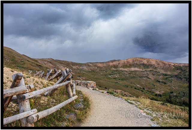
A trail near the summit of Loveland Pass A view of a trail leading up to the mountain tops at the summit of Loveland Pass on the Continental Divide in Colorado. Photo taken: September 6, 2013, at Loveland Pass, Summit County, Colorado.

A Fence At The Garden of the Gods

Image
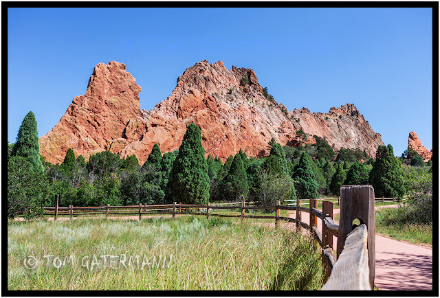
September 5, 2013. Colorado Springs, CO.

Union Pacific Coal Train on the Orin Subdivision

Image
August 23, 2005. Southeast of Wright, WY. In this image the entire length of a Union Pacific coal train can be seen, as it rolls north on the BNSF's Orin Subdivision in the Powder River Coal Basin. The lead locomotives are just over the slight hump near the two block signals in the far distance. This was taken alongside Hilight Road, somewhere between Hwy 450 and Edwards/Reno Road. Photo © Tom Gatermann

All images/photographs are copyrighted © by Tom Gatermann. All rights reserved. Contact me. Subscribe.