Posts

Showing posts with the label mountains

A tree line view - Rocky Mountain National Park

Image
Rocky Mountain National Park While driving along Trail Ridge Road in Rocky Mountain National Park , this line of trees caught my against the mountains behind them. I like how the cloud passing overhead and casting its shadow on the mountain between the trees and the far mountain allows the trees to stand out a bit more from the background.  This photograph was taken approximately six to seven miles (9.65 to 11.2 km) north of the Kawuneeche Visitor Center along Trail Ridge Road (US 34). The Kawuneeche Visitor Center is north of Grand Lake, Colorado. Photo taken: September 4, 2013, at Rocky Mountain National Park.

A dash of light, seen from Mount Evans in the Rocky Mountains

Image
A view from Mount Evans While driving down from Mount Evans, in the Rocky Mountains , I spotted this streak of light poking through the clouds. The view is looking west, from Squaw Pass Road (Rt. 103), toward a ridge line between Alpine Peak and Sugarloaf Peak. There had been a bit of rain on and off as I drove down from the summit of Mount Evans, but by the time I reached this point the clouds were starting to break up and the rain was moving away. Photo taken: September 2, 2013, west of Evergreen, CO., and southwest of Idaho Springs, Colorado.

A Sunset at Dillon, As Rain Falls Over the Rocky Mountains

Image
Sunset at Dillon Looking west across Dillon Reservoir at sunset.  Photo taken: September 3, 2013, at Dillon, Colorado.

A view of Lake Granby and Rocky Mountain National Park

Image
Lake Granby While driving up US 34 from Granby, Colorado, to Rocky Mountain National Park , I stopped off at Lake Granby. This view is looking eastward out over Lake Granby, toward Rocky Mountain National Park. This location is, approximately, six miles (10 km) north of Granby. Photo taken: September 4, 2013. Granby, Colorado.

A trail on the Continental Divide - Loveland Pass - Rocky Mountains

Image
A trail near the summit of Loveland Pass A view of a trail leading up to the mountain tops at the summit of Loveland Pass on the Continental Divide in Colorado. Photo taken: September 6, 2013, at Loveland Pass, Summit County, Colorado.

Truck on Loveland Pass - Continental Divide - Rocky Mountains

Image
Loveland Pass 9 (US 6) A truck carrying automobiles makes its way down the steep grade of Loveland Pass (U.S. Highway 6) on the eastern side of the Continental Divide. According the the Colorado Department of Transportation, the grades on this highway are as high as six percent. With an elevation of 11,992 feet, the road reaches the second highest elevation of a Colorado mountain pass, one spot behind Independence Pass (State Highway 29) which reaches 12,095 feet. While I'm not sure if this truck was had to use Loveland Pass instead of Interstate 70's Eisenhower Tunnel , trucks that are carrying hazardous materials are required to use the pass instead of the tunnel. Photo taken: September 6, 2013, at Loveland Pass in Colorado.

Rocky Mountain National Park - Fairview Curve Viewpoint - II

Image
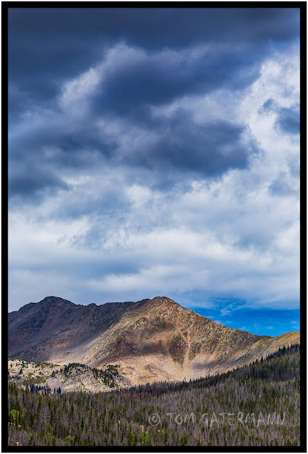
Rocky Mountain National Park A mountain view from Fairview Curve Viewpoint , along Trail Ridge Road (US 34) in Rocky Mountain National Park. While I am not sure, I believe this view is looking toward Red Mountain. Photo taken: September 4, 2013, at Rocky Mountain National Park, Colorado.

A Minivan - Trail Ridge Road - Rocky Mountain National Park

Image
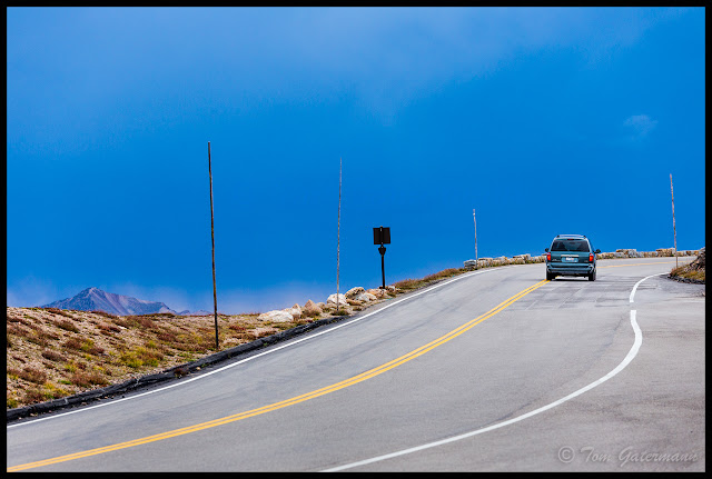
A minivan on Trail Ridge Road This lone minivan is making its way up Trail Ridge Road (US 34) in Rocky Mountain National Park , as some dark rain clouds began to move in over the mountains. It didn't end up raining where I took this photograph from, but it looked like it might. The poles alongside the road show where the road's side is when there is snow. Photo taken: September 4, 2013, at Rocky Mountain National Park.

A Lone Car Drives Up Mount Evans Road on Mount Evans

Image
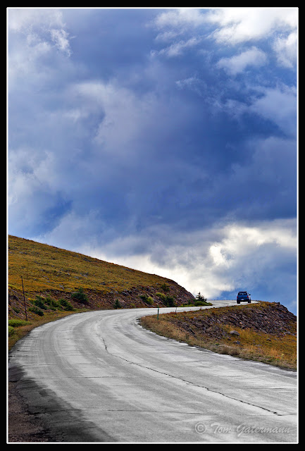
Mount Evans Road As storm clouds pass overhead, a lone car makes its way up Mount Evans Road on Mount Evans, in the Rocky Mountains.While this car was on its journey to the top of the mountain, I had begun my descent back down. Photo taken: September 2, 2013, at Mount Evans, Colorado.

Clouds Above Echo Lake - Mount Evans - Rocky Mountains

Image
Lake Echo As I drove down from the summit of Mount Evans , I saw these clouds looming over Lake Echo, so I pulled over and grabbed a few photographs. At it longest and widest points, the lake is about 1,500 feet (454 meters) long and 800 (235 meters)feet wide, however, from this view point the lake looks very small against vast mountains and sky. Photo taken: September 2, 2013, at Mount Evans.

A panoramic view looking across Lake Las Vegas - Aug. 2010

Image
Lake Las Vegas - Henderson, NV This is a multi-image panorama that was stitched together in Photoshop. The view is looking across Lake Las Vegas. I took these images while driving from Las Vegas to Hoover Dam . Photograph taken: August 18, 2010. Henderson, Nevada.

All images/photographs are copyrighted © by Tom Gatermann. All rights reserved. Contact me. Subscribe.